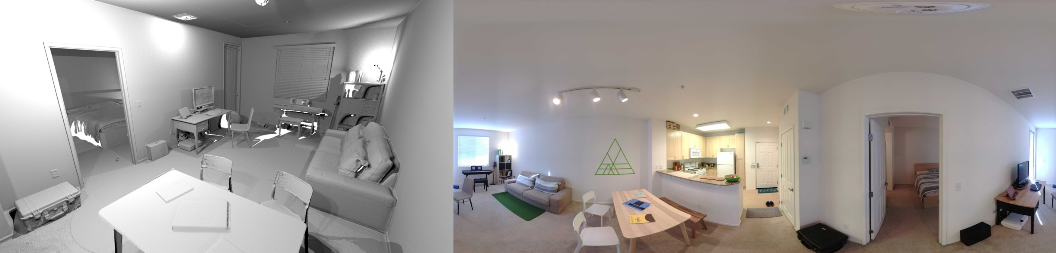
Apartment
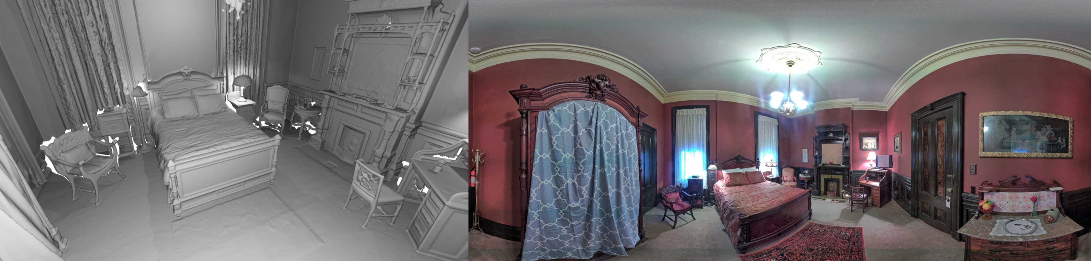
Bedroom

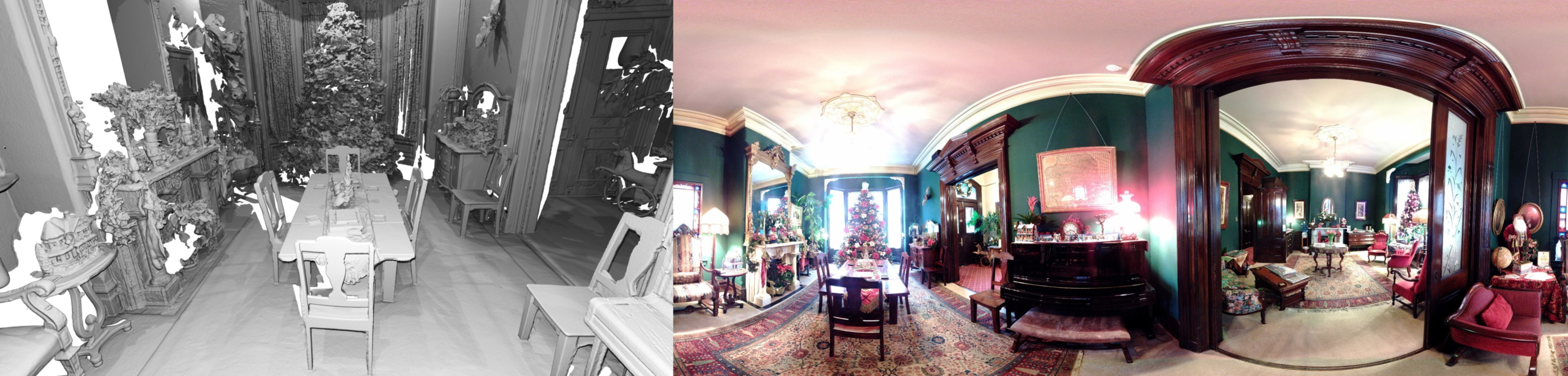
Boardroom
Lobby
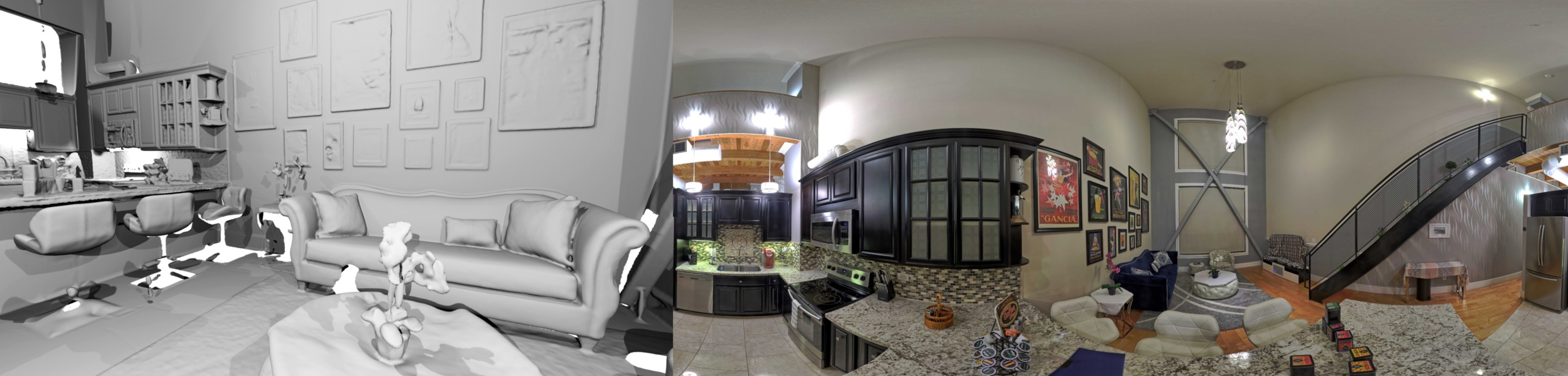
*Images shown above are meshed Lidar scan renderings (left) and 360 panorama images (right).
To our knowledge, no publicly available RGB-D dataset provides dense ground-truth surface geometry across largescale real-world scenes. To complement existing datasets, we have created ground-truth models of five complete indoor environments using a high-end laser scanner, and captured RGB-D video sequences of these scenes. This data enables quantitative evaluation of real-world scene reconstruction.
@inproceedings{Park2017,
	author    = {Jaesik Park and Qian-Yi Zhou and Vladlen Koltun},
	title     = {Colored Point Cloud Registration Revisited},
	booktitle = {ICCV},
	year      = {2017},
}